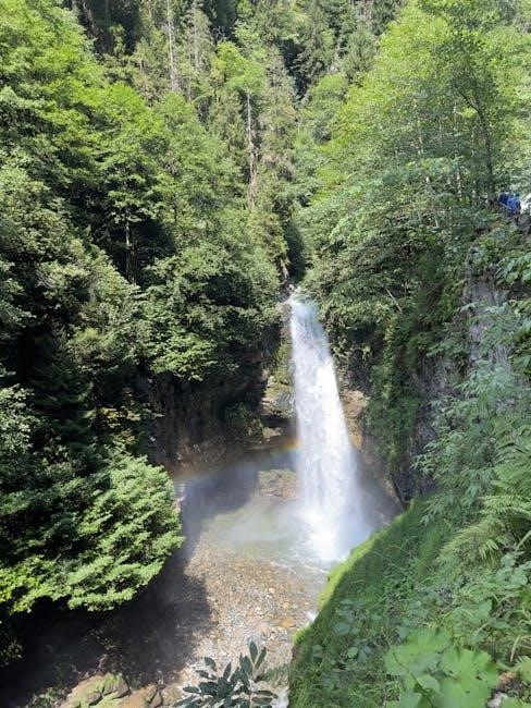
Zion National Park, located in Utah, is a stunning destination known for its red rock canyons and unique rock formations. Visitors can explore Zion Canyon, Kolob Canyons, and Lava Point using detailed maps available in PDF format for easy navigation.

Types of Zion Maps Available
Zion offers various maps, including regional maps showing nearby attractions and trail maps highlighting hiking routes. Road maps detail tunnels and shuttle stops, while wilderness maps focus on protected areas. PDF versions are available for easy access.
Regional Maps
Regional maps of Zion National Park provide a broad overview of the area, highlighting its location relative to other major attractions like Bryce Canyon, Grand Canyon National Park, and Las Vegas. These maps are essential for planning trips, as they show the proximity of Zion to other popular destinations, allowing visitors to plan their itineraries efficiently. The maps often include major highways and roads, such as Highway 89, which connects Zion to nearby parks and cities like Kanab, Utah, and Page, Arizona. Additionally, regional maps may outline the layout of surrounding areas, including Cedar City and Salt Lake City, making them useful for travelers who want to explore beyond Zion. These maps are available in PDF format, ensuring easy downloading and printing for use during travels. By offering a comprehensive view of the region, regional maps help visitors contextualize Zion within the larger landscape of the American Southwest.
Trail Maps
Zion National Park offers detailed trail maps that are indispensable for hikers and adventurers. These maps provide precise information about the park’s extensive trail network, including popular routes like Angel’s Landing, the Narrows, and Emerald Pools. Trail maps highlight trail lengths, difficulty levels, and scenic viewpoints, helping visitors choose paths that match their abilities and interests. Key features such as shuttle stops, trailheads, and intersections are clearly marked, ensuring easy navigation. The maps also indicate areas with restricted access or special regulations, such as the wilderness zones protected under the 1964 Wilderness Act. By downloading these maps in PDF format, visitors can plan their hikes in advance and carry a reliable guide during their explorations. Additionally, trail maps often include tips on safety, weather conditions, and wildlife encounters, making them a vital resource for a safe and enjoyable experience in Zion’s stunning landscapes.
How to Download Zion Maps
Visit the official Zion National Park website or third-party platforms like national park apps and outdoor websites. These sources offer free downloadable PDF maps, ensuring easy access for planning and navigation without internet connectivity.
Official Sources
The most reliable way to obtain Zion maps is through official sources, such as the National Park Service website or park brochures. The official Zion National Park website provides free downloadable PDF maps, including the main park map, regional maps, and brochures. These resources are updated regularly to ensure accuracy and relevance for visitors.
- The main Zion map highlights key attractions like Zion Canyon, Kolob Canyons, and Lava Point, along with roads, trails, and shuttle stops.
- Regional maps offer a broader view, showing Zion’s location relative to nearby parks like Bryce Canyon and the Grand Canyon.
- The official park brochure, available in PDF format, includes a detailed map and essential information for planning a visit.
These official maps are indispensable for visitors, providing clear guidance for navigating the park’s natural wonders and ensuring a well-planned adventure. They also emphasize conservation efforts, such as the protection of 84% of the park as wilderness under the 1964 Wilderness Act.
Third-Party Sources
Beyond official sources, third-party websites and platforms offer a variety of Zion maps in PDF format, catering to different needs and preferences. These sources often provide additional features or perspectives that complement the official maps, making them a valuable resource for visitors.
- Online marketplaces like Etsy or specialized map websites offer illustrated Zion maps, combining artistic design with functional details for trip planning.
- Stock image platforms provide high-resolution Zion maps, including vector graphics, which are ideal for professional or creative projects;
- Third-party apps and travel websites often include downloadable PDF maps tailored for specific activities, such as hiking or road trips.
- Some third-party sources focus on regional maps, highlighting Zion’s location relative to other attractions like Bryce Canyon, Grand Canyon, and Las Vegas.
While these sources are not affiliated with the park, they can enhance your planning experience by offering unique visuals, detailed trail information, and practical tips for exploring Zion National Park. Always verify the credibility of third-party sources to ensure accuracy.

Key Features of Zion Maps
Zion maps are designed to provide visitors with essential information for navigating the park’s diverse landscapes and attractions. One of the key features of these maps is the detailed representation of trails, including popular routes like Angels Landing and the West Rim Trail, as well as lesser-known paths in the Kolob Canyons.
- Maps highlight major attractions such as Zion Canyon, the Virgin River Narrows, and Lava Point, helping visitors plan their itineraries effectively;
- Conservation areas and wilderness zones are clearly marked, emphasizing protected regions to promote environmental awareness and responsible exploration.
- Shuttle stops and road access points are prominently displayed, allowing visitors to navigate the park’s transportation system efficiently.
- Many maps include symbols and legends to denote facilities like restrooms, picnic areas, and visitor centers, ensuring convenience for all users.
These features make Zion maps indispensable tools for both first-time visitors and experienced explorers, ensuring a safe and enjoyable experience in one of Utah’s most breathtaking natural wonders.

Historical and Cultural Significance
Zion National Park holds a rich historical and cultural legacy, reflected in its landscapes, archaeological sites, and preserved natural wonders. The park’s unique rock formations and canyons have been home to various indigenous cultures for thousands of years, including the Ancestral Puebloans and Paiute people.
In 2009, Congress designated nearly 84% of Zion as wilderness under the Wilderness Act of 1964, safeguarding its natural and cultural resources for future generations. This designation protects the park’s primitive character, scientific value, and historical sites from human impact.
Zion maps often highlight areas of cultural importance, such as ancient petroglyphs and ruins, allowing visitors to connect with the park’s storied past. These visual elements serve as a bridge between modern exploration and the region’s deep-rooted heritage.
By preserving its wilderness and cultural sites, Zion National Park stands as a testament to Utah’s natural and historical treasures, offering visitors a chance to explore and appreciate its enduring significance.

Wilderness and Conservation
Zion National Park is a beacon of wilderness conservation, with nearly 84% of its land protected under the 1964 Wilderness Act. This designation ensures the preservation of its natural conditions, solitude, and scientific values for future generations.
The park’s wilderness areas are characterized by their pristine landscapes, diverse ecosystems, and untouched natural beauty. Conservation efforts focus on maintaining the park’s ecological balance and protecting its unique geological formations.
Visitors to Zion are encouraged to respect these protected lands by adhering to regulations, such as using bear-proof containers and avoiding graffiti or vandalism. These measures help preserve the park’s wilderness character and cultural sites.
Zion maps often highlight wilderness boundaries and restricted areas, guiding visitors to explore responsibly. By prioritizing conservation, Zion National Park remains a timeless example of wild beauty and environmental stewardship.

Using Zion Maps for Planning
Zion maps are indispensable tools for planning a successful and enjoyable visit to the park. They provide detailed insights into the park’s layout, trails, and attractions, helping visitors make informed decisions about their itinerary.
The maps highlight key areas such as Zion Canyon, Kolob Canyons, and Lava Point, allowing visitors to identify must-see destinations. They also indicate main roads, tunnels, and shuttle stops, which are essential for navigating the park efficiently.
By studying the maps, visitors can determine the best park entrance to use based on their accommodations and plans. This helps in minimizing travel time and maximizing exploration opportunities.
Additionally, Zion maps are available in PDF format, making them easy to download and access on mobile devices. This convenience ensures that visitors can plan their trips beforehand and stay organized during their visit.
Overall, Zion maps are crucial for creating a well-planned and stress-free experience in one of Utah’s most breathtaking natural wonders.

Visual Elements and Design
Zion maps are thoughtfully designed to enhance visitor experiences through clear visual elements. The maps feature detailed illustrations of Zion Canyon, Kolob Canyons, and Lava Point, ensuring landmarks are easily identifiable. Vibrant colors and distinct symbols differentiate trails, roads, and points of interest, making navigation intuitive.
The use of bold typography highlights key attractions, while subtle shading emphasizes terrain variations. Icons for facilities like shuttle stops and rest areas are strategically placed to aid planning. Digital versions, such as the Zion map PDF, maintain these design elements, ensuring clarity on mobile devices.
These visual cues not only improve readability but also preserve the aesthetic appeal of the park’s natural beauty. The design ensures that visitors can quickly locate essential information, fostering a seamless exploration of Zion’s stunning landscapes.
Overall, the maps’ visual elements and design balance functionality with aesthetics, providing users with both practical guidance and an appreciation for the park’s unique geography.
